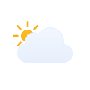
 Mostly cloudy
Feels like 84°F
Wind direction N
Gusts 14 mph
Humidity 51%
Cloud cover 73%
Pressure 30.15 inHg
Now · 11:26 AM
United States · Mississippi
 Mostly cloudy
Partly cloudy
Mostly cloudy
Partly cloudy
 Sunny
Sunny
 Overcast night
 Mostly cloudy night
 Partly cloudy night
Mostly clear night
Sunny
Partly cloudy
Overcast
Overcast
Mostly cloudy night
Mostly cloudy night
Partly cloudy night
Mostly cloudy night
Mostly sunny
Mostly cloudyMostly cloudyMostly cloudyPartly cloudyPartly cloudyPartly cloudySunny
Partly cloudy night
Mostly clear night
Sunny
Partly cloudy
Overcast
Overcast
Mostly cloudy night
Mostly cloudy night
Partly cloudy night
Mostly cloudy night
Mostly sunny
Mostly cloudyMostly cloudyMostly cloudyPartly cloudyPartly cloudyPartly cloudySunny Clear nightClear nightOvercast nightOvercast nightMostly cloudy nightMostly cloudy nightPartly cloudy nightPartly cloudy nightPartly cloudy nightClear nightMostly clear nightMostly clear nightMostly sunnyPartly cloudySunnySunnySunnyPartly cloudyMostly cloudyOvercastOvercastOvercastOvercastOvercastOvercast nightOvercast nightMostly cloudy nightPartly cloudy nightMostly cloudy nightMostly cloudy nightMostly cloudy nightPartly cloudy nightPartly cloudy nightOvercast nightOvercast nightMostly cloudy nightPartly cloudyPartly cloudyMostly sunnySunnySunnySunnySunnySunnyMostly sunnyMostly sunnyPartly cloudyMostly cloudyMostly cloudy night
In Splinter and, more broadly, across the state of Mississippi: The morning begins with a mix of sun and clouds, bringing warm conditions that are expected to continue into the afternoon. Temperatures will climb into the high 80s and low 90s, making for a hot day. Light west winds will blow at around 4 mph, with occasional gusts reaching up to 11 mph. There is a possibility of rain, with some areas receiving around 0.36 inches of accumulation, and the maximum probability of rain is about 76%. Overall, it should be a warm day with a chance of some showers, so it’s a good idea to carry an umbrella if you plan to be outdoors.
Mostly cloudy
85°/64°
💧 0 in
💨 7 mph
Mostly cloudy
87°/67°
💧 0 in
💨 6 mph
TEMPERATURE OUTLOOK
AIR QUALITY FORECAST
Air quality is favorable for outdoor activities.
Air quality is favorable for outdoor activities.
Air quality is acceptable for most people.
Air quality is favorable for outdoor activities.
Air quality is acceptable for most people.
Air quality is favorable for outdoor activities.
Air quality is favorable for outdoor activities.
Air quality is acceptable for most people.
Air quality is favorable for outdoor activities.
Air quality is acceptable for most people.
Air quality is acceptable for most people.
Air quality is favorable for outdoor activities.
Air quality is favorable for outdoor activities.
Air quality is favorable for outdoor activities.
Air quality is acceptable for most people.
Air quality is acceptable for most people.
Air quality is favorable for outdoor activities.
Air quality is acceptable for most people.
Air quality is favorable for outdoor activities.
Air quality is acceptable for most people.
Air quality is favorable for outdoor activities.
Air quality is favorable for outdoor activities.
Air quality is acceptable for most people.
Air quality is favorable for outdoor activities.
Air quality is acceptable for most people.
HEALTH & EXPOSURE
Sunglasses and sun protection are recommended for prolonged exposure.
Air quality is acceptable for most people. Very sensitive people may want to reduce prolonged exertion.
Drink water regularly, especially during physical activity or prolonged sun exposure.
Outdoor activities can generally be enjoyed normally, with sun protection adjusted to the UV level.
WIND OUTLOOK
The technical data used to calculate this forecast for Splinter were updated today at 11:26 AM. The displayed forecasts cover the period through 27/09/2026 at 9:00 AM. Weather and air-quality data provided by WEATHER-INFO.COM. UV-index data derived from ECMWF UVB by WEATHER PORTAL. Weather information is generated automatically and periodically reviewed by our technical team.
Excellent observing conditions. Best local viewing window: 4:00 AM–5:00 AM.
Experimental local observing estimate. Weather values come from the hourly forecast already used on this page. Moon position and astronomical darkness are calculated locally from time and coordinates. Meteor-shower ZHR describes ideal conditions and is not the number of meteors a person should expect to see locally.